Southern, central, and northern segments
The San Andreas Fault can be divided into three segments.
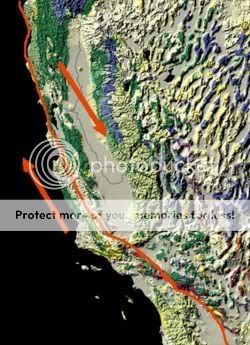
The southern segment (known as the Mojave segment) begins near the Salton Sea at the northern terminus of the East Pacific Rise and runs northward before it begins a slow bend to the west when it meets the San Bernardino Mountains. Here, it runs along the southern base of the San Bernardino Mountains, crosses through the Cajon Pass and continues to run northwest along the northern base of the San Gabriel Mountains. These mountains are a result of movement along the San Andreas Fault and are commonly called the Transverse Range. This segment of the fault is the most commonly analyzed of any fault in the world by geologists. This is due to a cutout of the fault in Palmdale (the second largest city directly sitting on the fault) where the Antelope Valley Freeway passes through it, and the deep layers of "shifted" crust can clearly be seen.
After crossing through Frazier Park, the fault begins to bend northwards. This area is referred to as the "Big Bend" and is thought to be where the fault locks up in Southern California as the plates try to move past each other. This section of the fault has a recurrence interval of roughly 140-160 years. Northwest of Frazier Park, the fault runs through the Carrizo Plain, a long, treeless plain within which much of the fault is plainly visible. The Elkhorn Scarp defines the fault trace along much of its length within the plain.
The central segment of the San Andreas fault runs in a northwestern direction from Parkfield to Hollister. While the southern section of the fault and the parts through Parkfield experience earthquakes, the rest of the central section of the fault exhibits a phenomenon called aseismic creep. This term describes the fault being able to move without causing earthquakes.
The northern segment of the fault runs from Hollister, through the Santa Cruz Mountains, epicenter of the 1989 Loma Prieta earthquake, then on up the San Francisco Peninsula, where it was first identified by Professor Lawson in 1895, then offshore at Pacifica at Mussel Rock. This is the approximate location of the epicenter of the 1906 earthquake. The fault returns onshore at Bolinas Lagoon just north of Stinson Beach in Marin County. It returns underwater through the linear trough of Tomales Bay which separates the Point Reyes Peninsula from the mainland, returning onshore at Fort Ross. From there it continues overland, forming in part a linear valley through which the Gualala River flows. It goes back offshore at Point Arena. After that, it runs underwater along the coast until it nears Cape Mendocino, where it begins to bend to the west, terminating at a triple junction with the Mendocino Fracture Zone and the Cascadia subduction zone. To the north lies the Gorda Plate which is being subducted under the margin of the North American plate.